Marine Weather – Southeast Coast
This application is for the Southeastern US mariner covering from North Carolina through Key West, Florida. The Gulf Coast Marine Weather App covers the west coast of Florida.
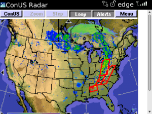
This application provides internet links via the BlackBerry browser to current weather conditions, wave heights, surface winds as well as sea surface temperature, which are presented graphically, for the current time frame and 24 hours into the future. Animated, High resolution, regional radar imagery for locations from North Carolina to Key West, Florida out to ~100 miles as well as Animated national radar displays with weather warning watch boxes and weather warning displays.
Extensive text based forecasts, messages, statements,warnings and Buoy reports are also provided as is a SE US Coast Tides utility.
Among the features are:
Color, HiRes charts and displays showing:
Animated Color Radar w/watch boxes and warnings.
Animated Hi Res Color location Specific Radars.
Current Forecast Atlantic Sea Surface Temperatures.
Current Forecast Surface Wind Speeds and Direction.
Current Forecast Wave height and swell direction.
Visible, IR, Water Vapor plus animated color satellite imagery.
Current Barometric Pressure Isobar Chart.
Current Synoptic Weather Map.
Forecast Weather Maps +12, +24 +48 hours.
Forecast Precip Maps +12, +24 +48 hours.
Severe Weather forecasts Current day and +24 Hours.
NOAA Text Products:
Hazardous Weather Marine Forecasts.
Buoy Reports from North Carolina to Key West Florida.
Short Term Forecasts.
Area Weather Discussions.
Open Waters Forecasts.
Near Shore Forecasts.
Marine Messages.
Marine Statements.
Marine Warnings.
SE US Coast Tides North Carolina to Miami, FL.
This application displays information obtained from free internet weather sites in order to avoid having to charge you a monthly access fee.

App Name:Marine Weather – Southeast Coast
App Version:3.0.0
App Size:13 KB
Cost:US$9.99 USD